Whitsett Cemetery
Rockingham County, North Carolina, USA – *No GPS coordinates
About
-
- Cemetery ID:
Members have Contributed
- 11 Memorials
- 55% photographed
- No location information available Add Location
Advertisement
Photos


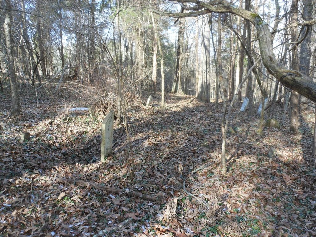
This cemetery is thought to have been the site of an early church.
Many graves...some hand-carved...
There is no longer a McNutt Farm.
Eight graves are marked with field stones but many unmarked graves are there.
Some of the "old timers" say that it was once a huge cemetery.
(near the border of Rockingham and Guilford counties)
The cemetery is located on land that was owned by James Whitsett and his wife, Nancy Moore.
Directions:
From the intersection of N. Church Road and Scalesville Road, the cemetery is on the left at about .6 of a mile. There are some cedars at the tree line, not too far from the road.
At about .25 of a mile you'll see on your right a small farm road with a metal gate.
About .3 of a mile farther, you'll see another little farm road on the right with a metal gate.
The cemetery is just across the road from the second farm road and gate.
(Thanks to Jan Bellard)
.
You can tell by looking at the photos that this was once a huge cemetery.
All we need are some volunteers to help rake the leaves and find all the people who are buried there before it is lost forever.
How about a boy scout group ?
Or Preservation group ?
.
Nearby cemeteries

Reidsville, Rockingham County, North Carolina, USA
- Total memorials8k+
- Percent photographed89%
- Percent with GPS2%

Eden, Rockingham County, North Carolina, USA
- Total memorials5k+
- Percent photographed90%
- Percent with GPS0%

Reidsville, Rockingham County, North Carolina, USA
- Total memorials4k+
- Percent photographed85%
- Percent with GPS1%

Reidsville, Rockingham County, North Carolina, USA
- Total memorials3k+
- Percent photographed92%
- Percent with GPS5%
- Added: 6 Jun 2011
- Find a Grave Cemetery ID: 2405239

Cemetery Photos
This is a carousel with slides. Use Next and Previous buttons to navigate, or jump to a slide with the slide dots. Use Escape keyboard button or the Close button to close the carousel.


Success
Uploading...
Waiting...
Failed
This photo was not uploaded because this cemetery already has 20 photos
This photo was not uploaded because you have already uploaded 5 photos to this cemetery
This photo was not uploaded because you have already uploaded 5 photos to this cemetery
Invalid File Type
Birth and death years unknown.
1 photo picked...
2 photos picked...
Uploading 1 Photo
Uploading 2 Photos
1 Photo Uploaded
2 Photos Uploaded
Size exceeded
Too many photos have been uploaded
"Unsupported file type"
• ##count## of 0 memorials with GPS displayed. Double click on map to view more.No cemeteries found