Hardin Cemetery
Hardin, Ray County, Missouri, USA
About
-
- Cemetery ID:
Members have Contributed
Advertisement
Photos


The earliest burial recorded was in 1828. The records of the cemetery were lost in the early 1900‚s; and what is reported here is what could be reconstructed from old deeds and other records. On April 13, 1872, the trustees of the Walnut Grove Church (W. Snowden, Henry Boggess, and W. Hughes) purchased for the sum of $50 three acres of ground from John W. Smith. The deed stated that the land was being reserved for the burying ground of the Snowden relatives. It is recorded in the Hardin Methodist Church History that the last building for the Walnut Grove Church was built in 1859 on an acre of ground bought from Scyrena and J.H. Snowden. This building stood on the southeast coroner of the cemetery. It is believed that the last services held in the Walnut Grove church building was held in 1888.
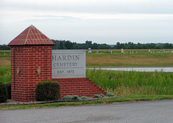
On October 4, 1905, W. Snowden, Henry Boggess, and W. Hughes, trustees of the church transferred ownership of the graveyard to the Hardin Cemetery Association for the sum of $1. The original size of the cemetery was one acre; after purchasing the three Walnut Grove acres, five more acres were purchased in 1919. On March 14, 1919, the Hardin Cemetery Association purchased the 5 acres for the sum of $1250 from Emma D. and Charles Sevier. In 1946 a shelter house and tool storage building was built at a cost of $1058.59. In 1960, a new cemetery entrance from Missouri Highway 10 was created; this entrance displayed brick pillars and a sign designating the Hardin Cemetery.
Re-organization of the Hardin Cemetery Association was done at a meeting held on April 3, 1968. Officers elected at this meeting were; Dan Myers - President, Julius Merrifield - Vice-President, Temple Knipschild - Secretary, Allen Rhodes - Treasurer. On July 12, 1993 the flood waters that were ravaging the Missouri River Valley topped the levee at the south entrance of the cemetery and dug a „blue hole‰ in the center of the cemetery 90 ft. deep and destroying two-thirds of the cemetery. When the water receded two-thirds of the cemetery was destroyed. It was determined that 793 of the 1576 burials were displaced. With the help of the Missouri Funeral Directors Association, under the leadership of Dean Snow, Ray County Coroner, 645 remains were recovered. 120 of the recovered bodies were identified and reburied. The 525 bodies that were not identified were buried in a section of the cemetery now referred to as the Unknown Section. A Memorial Service was held December 5, 1993 to remember these loved ones.
This has been classified as the worst cemetery disaster in the history of the United States receiving nationwide and worldwide coverage.
July 30, 1995 a redaction service was held. In the year of 1996 the jobs of reseeding the grass, planting trees, finishing and blacktopping the access roads, and making plans for memorials were accomplished. April 17, 1997 the Deed purchasing 9.5 acres from Gill Family Investments LC was signed. This is the ground that was used to rebuild the cemetery. In 1997 the memorials were installed. In 1998 a bronze plaque was installed listing the names of the Unknowns and adding to the entrance off of Highway 10, and finishing the landscaping.
The earliest burial recorded was in 1828. The records of the cemetery were lost in the early 1900‚s; and what is reported here is what could be reconstructed from old deeds and other records. On April 13, 1872, the trustees of the Walnut Grove Church (W. Snowden, Henry Boggess, and W. Hughes) purchased for the sum of $50 three acres of ground from John W. Smith. The deed stated that the land was being reserved for the burying ground of the Snowden relatives. It is recorded in the Hardin Methodist Church History that the last building for the Walnut Grove Church was built in 1859 on an acre of ground bought from Scyrena and J.H. Snowden. This building stood on the southeast coroner of the cemetery. It is believed that the last services held in the Walnut Grove church building was held in 1888.
On October 4, 1905, W. Snowden, Henry Boggess, and W. Hughes, trustees of the church transferred ownership of the graveyard to the Hardin Cemetery Association for the sum of $1. The original size of the cemetery was one acre; after purchasing the three Walnut Grove acres, five more acres were purchased in 1919. On March 14, 1919, the Hardin Cemetery Association purchased the 5 acres for the sum of $1250 from Emma D. and Charles Sevier. In 1946 a shelter house and tool storage building was built at a cost of $1058.59. In 1960, a new cemetery entrance from Missouri Highway 10 was created; this entrance displayed brick pillars and a sign designating the Hardin Cemetery.
Re-organization of the Hardin Cemetery Association was done at a meeting held on April 3, 1968. Officers elected at this meeting were; Dan Myers - President, Julius Merrifield - Vice-President, Temple Knipschild - Secretary, Allen Rhodes - Treasurer. On July 12, 1993 the flood waters that were ravaging the Missouri River Valley topped the levee at the south entrance of the cemetery and dug a „blue hole‰ in the center of the cemetery 90 ft. deep and destroying two-thirds of the cemetery. When the water receded two-thirds of the cemetery was destroyed. It was determined that 793 of the 1576 burials were displaced. With the help of the Missouri Funeral Directors Association, under the leadership of Dean Snow, Ray County Coroner, 645 remains were recovered. 120 of the recovered bodies were identified and reburied. The 525 bodies that were not identified were buried in a section of the cemetery now referred to as the Unknown Section. A Memorial Service was held December 5, 1993 to remember these loved ones.
This has been classified as the worst cemetery disaster in the history of the United States receiving nationwide and worldwide coverage.
July 30, 1995 a redaction service was held. In the year of 1996 the jobs of reseeding the grass, planting trees, finishing and blacktopping the access roads, and making plans for memorials were accomplished. April 17, 1997 the Deed purchasing 9.5 acres from Gill Family Investments LC was signed. This is the ground that was used to rebuild the cemetery. In 1997 the memorials were installed. In 1998 a bronze plaque was installed listing the names of the Unknowns and adding to the entrance off of Highway 10, and finishing the landscaping.
Nearby cemeteries

Hardin, Ray County, Missouri, USA
- Total memorials20
- Percent photographed80%
- Percent with GPS0%

Hardin, Ray County, Missouri, USA
- Total memorials727
- Percent photographed77%
- Percent with GPS0%
- Added: 1 Jan 2000
- Find a Grave Cemetery ID: 29140

Cemetery Photos
This is a carousel with slides. Use Next and Previous buttons to navigate, or jump to a slide with the slide dots. Use Escape keyboard button or the Close button to close the carousel.


Success
Uploading...
Waiting...
Failed
This photo was not uploaded because this cemetery already has 20 photos
This photo was not uploaded because you have already uploaded 5 photos to this cemetery
This photo was not uploaded because you have already uploaded 5 photos to this cemetery
Invalid File Type
Birth and death years unknown.
1 photo picked...
2 photos picked...
Uploading 1 Photo
Uploading 2 Photos
1 Photo Uploaded
2 Photos Uploaded
Size exceeded
Too many photos have been uploaded
"Unsupported file type"
• ##count## of 0 memorials with GPS displayed. Double click on map to view more.No cemeteries found